This article is part 2 of a series on what’s involved when navigating across the English Channel and covers estimating the effect of tide during the crossing.
- Determine your departure time (which often depends on when you want to arrive or when you must arrive by)
- Estimating the net tidal set and drift you’ll experience during the crossing
- Determine your course to steer by applying tide, variation, deviation and leeway
- Final course shaping a couple of hours before arrival
In the previous article, we looked at the factors involved in determining our departure time. The next step is to work out the net tidal vector during our 13 hours crossing.
Determining the effect of tide
It might seem intuitive to sail first to a waypoint midpoint across the channel (netting out one direction of tide) and then another to the destination, but in fact this results in a longer ground track. The uninitiated might even work out several courses to steer but this leads to a very inefficient course.
The answer is to plot a single course to steer for the entire crossing rather than involving mid-Channel waypoints. Suffice to say, it will be a far quicker crossing if you take this established approach. Your ground track will swing you east or west with the tide and then back again. The question is by how much.
In order to work this out, you will need to consult a Channel tidal stream atlas in order to determine each hourly, and therefore a net total, tidal drift anticipated.
Sources of tidal stream data in the English Channel
There are two widely used sources for this:-
- The classic reference is the Admiralty Tidal Stream Atlas for the English Channel
- However, I much prefer Reeve-Fowkes Yachtsman’s Manual of Tides.
The first third of Reeve-Fowkes is a superbly written text on how to use the tides to your advantage as a yachtsman; the remainder is the atlas itself. The real advantages to this atlas (over the Admiralty one) are built in tables avoiding the necessity to use the tedious Computation of Rates graph to account for springs/neaps, easier interpretation of the tide between measured locations together with the fact that everything is referenced to HW Cherbourg. During the summer, Cherbourg tidal tables are the same as British Summer Time so you can just leave your ship time alone for your trip.
Having made a note of time and height of high water Cherbourg from your Almanac – we’ll use 5.5m at 0840.
The process for estimating the net tidal vector
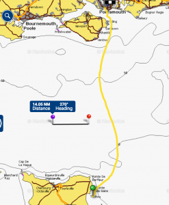
- Note down each hour of your planned crossing (Bembridge to Cherbourg) and the corresponding tidal hour (recall that each tidal hour covers 30 minutes either side)
- eg. The chartlet for Cherbourg HW-1 at 0740 covers 0710 through 0810
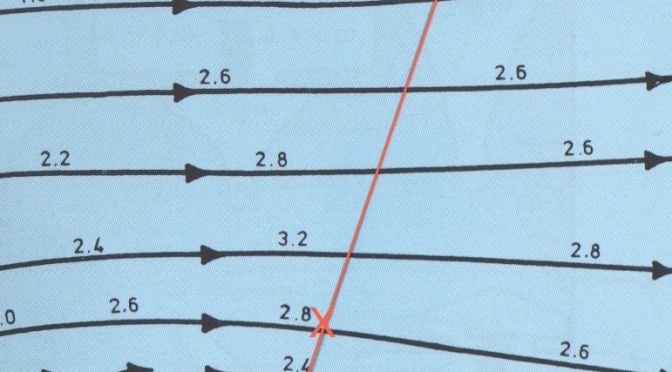
- For each tidal hour turn to corresponding atlas page and estimate your position at that time. It’s a little tedious but essentially mark of 6/13ths of the distance across the channel for the sixth hour. Although I’ve marked it here, you only need to make a note of the tidal rate at that point. Here it’s pretty simple – 2.5kts and you can see that I needed to interpolate between 2.4 and 2.8.
-
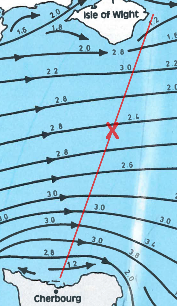
- Bembridge to Cherbourg HW-1, hour 6
- Next adjust for the tidal range (since we will always be somewhere between springs and neaps) to find your tidal drift for that hour
- Firstly, mark off HW Cherbourg for that day – 5.5m
- Second, find the rate from your plot above in the left hand column of the table – 2.5kts
- Then follow across to the adjusted rate by intersecting the HW line above – 2.3kts
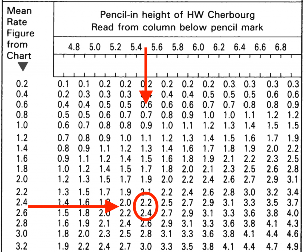
You need to repeat this for each hour of your crossing. I’d recommend attaching these rates & times to your passage plan as they come in handy for course shaping in the last few hours, or in the event of a GPS disaster.- Add up the total westerly tide and subtract it from total easterly tide to come up with a net tide east or west.
On my recent crossing to Cherbourg, for example, I expected
- a couple of hours easterly tide taking us a total of 1nm off the ground track
- then over the next full tide around 13.2nm west and
- finally 7.9nm east over the final 4 hours
This resulted in a total of 4.3nm westerly tide over the 13 hours. This assumed an average through the water boat speed of 5kts (65nm ÷ 5kts = 13 hours).
Having estimated your net tidal vector it’s now time to work out the course to steer.
As a newbie…. hugely useful articles for someone that’s just bought his first boat in the Solent. Thanks. Question: Rather than calculate the total drift why wouldn’t you just draw a compound vector diagram?
If by compound vector diagram you mean draw all the individual hourly tidal vectors, then you can. But we’re just interested in the net east/west and as this is almost all of each hourly vector then we just add them up. The resulting error is so tiny as to be negligible so we ignore it.
If you mean something else please clarify.